State explores wider use of drones, enables LCC students to learn at Oakridge Airport
9 min read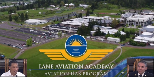
Oregon looks at the increasing use of drones and other emerging technologies, including flying cars. At the Joint Transportation Committee May 31:
[00:00:10] Kenji Sugahara: My name is Kenji Sugahara. I’m the director of the Oregon Department of Aviation. We’re a tiny agency, a staff of 15 that oversee 28 state-owned airports. And one of the interesting things that we have to take care of is advanced air mobility, which encompasses a lot of new technologies. If you think about it, it’s drones, flying cars (yes, it’s a thing, they’re real), urban air mobility (that is the flying car), and then regional cargo mobility, as well as regional air mobility.
[00:00:41] Rep. Paul Evans: Flying cars?
[00:00:43] Kenji Sugahara: Rep. Evans, yes, there are flying cars. They’re vertical takeoff and landing vehicles. We did have some at the test range in Pendleton. That was part of the Vahana Project that many of you might remember… Joby Aviation‘s vertical takeoff and landing, that’s down in Monterey. They did take it off the ground and they did deliver people. Yeah, there was a pilot there.
[00:01:05] Sen. Lew Frederick: If you remember, we passed a bill last year on vertiports. That’s the reason we did that. We have the possibility of vertiports in different places. And that’s because there are, in fact, those drones that are doing that.
[00:01:17] And 2015, the Ways and Means Committee had a tour. We found ourselves in Pendleton. We saw several of the flying cars there as well. Right now, they would have to be piloted, but we are not that far away in terms of AI situations.
[00:01:35] Kenji Sugahara: Sen. Frederick, absolutely, you’re right, it will be piloted for the foreseeable future. But how will it benefit communities, right, especially the rural economies? And one of them is regional cargo mobility, because what it does is it allows utilization of the small, rural airports that are underutilized at the moment to function as cargo hubs. So think about medical supplies being delivered from small airport to small airport, and it really makes things accessible.
[00:02:03] When you talk about regional passenger mobility, we talk about essential air service, right? You think about Pendleton, you think about North Bend. This gives opportunities for smaller airports to function almost in the same role, to get people from the smaller airports, rural airports, to larger transportation hubs.
[00:02:22] And that’s going to make a world of difference because you think about it, some people have to drive two, three hours to even get to an airport that can access larger destinations in other states. So. Thank you. There’s also, for example, medical and cargo delivery, and then there’s also public safety.
[00:02:40] John Q: With more details on drones in public safety:
[00:02:44] Jeff Pricher (Scappoose Fire District): My name is Jeff Pricher. I am the fire chief with the Scappoose Fire District and I’m also a board member with the Oregon Department of Aviation.
[00:02:51] Law enforcement has a significant use of these small uncrewed aircraft systems or UAS. Some people call them drones, but what we’ve been finding is that for a lot of their use cases, they’re really turning into a game changer for not only deescalating those threat matrix that the officers have to go through when they’re responding to calls, but also providing a safer environment for our law enforcement partners as they’re potentially having to enter into a building. They can mitigate stuff before they get there.
[00:03:22] And if you put yourself in the shoes of a law enforcement official having to pop their head up into an attic and someone’s there with something that we don’t want them to have, we’re able to take these little machines, fly them through small openings, and then clear an area safely so that they can do their job and then hopefully again deescalate the situation.
[00:03:40] And in a lot of cases now when the bad guys see the aircraft, they just give up, which is good.
[00:03:45] Law enforcement has a use with fatal crash reconstruction for actually saving the taxpayers millions of dollars by not having to shut down roads for as long as they used to be when we were doing the traditional methods.
[00:03:58] On the fire side, we’re pretty much using them for everything. There’s a lot that we have to go through, fire traffic area protocols are established on the wildland side and are very specific.
[00:04:09] Normally firefighters, they just see smoke. But now when we’re using the thermal imaging, we can actually direct the hose streams to where the fire is.
[00:04:18] We’re able to do a lot of modeling. This is something that is similar to what occurs with fatal crash reconstruction. We’re able to do 3-D renderings and then get down to centimeter grade level measurements, which not only speed up time, but make it more efficient for us, when we’re doing our jobs.
[00:04:33] Search and Rescue is another use case in public safety that we’re finding a lot of success with.
[00:04:39] When it comes to wildland (fire), which is a big consideration for us here in the state, we’re doing all sorts of different things with these uncrewed aircraft. NIROPS is the national infrared operation. And they’re not as detailed as what we’re able to do with the small machines. And when we’re getting those on the fire scene, we’re getting a lot more detail. The firefighters now are able to see where the hottest spots are, so when they start in the morning, they can go to the heat before just showing up and trying to hit everything at once.
[00:05:07] There’s collaboratives that are being worked on between Oregon Department of Forestry, private UAS operators.
[00:05:13] We did have some involvement with the aftermath of the Lahaina (Hawai’i) fire. We went and did some mapping to help out, but there’s some significant integrations where we’re able to do damage assessment a lot faster than we could have ever done before, and then provide data by integrating this with our ESRI GIS platforms.
[00:05:31] And then of course, when it comes to payload delivery, that’s one of the newer things that pretty much everybody is starting to get into.
[00:05:39] One of the things that’s really important to highlight with all of this wonderful technology is we’ve entered into a situation where we’ve got the drone before the pilot. And as we move forward, we really need to be thinking about how we can make things safer here in Oregon.
[00:05:54] So some of the challenges for public safety: Our Oregon Revised Statutes don’t line up with what we need to do in the field. when it comes to trying to understand what exigency means, the laws, they don’t work for us. There are several areas in ORS 837 that we have to go back and revisit.
[00:06:13] When we look at the future of drone as a first responder, talking about Gresham, Eugene, Bend, they’re looking at DFR. DFR is short for Drone as First Responder. It was initially developed in theory by Chula Vista down in California. And the thought process was, ‘Hey, when somebody calls 911, let’s get that aircraft out there. And if there’s something bad happening, we can get those images, whether they’re fire, law enforcement, to the responders.’ And as I said earlier, that could help deescalate or provide us valuable information to make the right decisions.
[00:06:45] But unfortunately the ORSes don’t allow us to actually do it the way it’s intended to be done, and that’s something we can come back and revisit.
[00:06:55] Kenji Sugahara: So, are we being left behind? Yeah, yeah, sort of, kind of. Montana’s using drones. Drone deliveries are actually happening in Arkansas, Virginia, Texas, North Carolina, and other states. Hawai’i is using drones for pest monitoring control. Other states are using them for mosquito control as well. Washington DOT, if you didn’t see the news recently, is actually using drones to spray off graffiti. So that’s a really interesting use. Massachusetts is using drones for railway inspection too. So there’s a lot of the states in the U.S. that are doing a lot of really cool and interesting things and very useful practices in ways of using drones for the public good as well.
[00:07:37] So: How about our industry? If you take a look the numbers, the number of jobs that Business Oregon was able to find was around 2,500 jobs. I think it’s a little bit more. I think there was some underreporting because a lot of the mom-and-pop Part 107, which is your basic certificate pilots, your real estate, your film and television, I don’t think a lot of them were reached.
[00:07:58] But one thing that they mentioned in their report, that one thing that was in common with all the states that really were successful with advanced air mobility and drones is they had a specific person who was in charge of air mobility or drones in the Department of Transportation or Economic Development. For us, we’d like it in Department of Aviation because, well, aviation, right?
[00:08:19] But one of the important things, and I think Sen. Frederick, you alluded to this, is workforce development. That’s one of the most important pieces for any aviation-related industry efforts that we make, because you have to have a ready set of students and people ready to enter the workforce.
[00:08:37] One thing that we’ve been doing at the agency is, we had a good conversation at the Hillsboro Air Show with CTEC (Career Technical Education Center), which is of course, Salem. And we also had O-ACE (Oregon Aerospace Careers for Everyone), which is out of Hillsboro. And we also had conversations with Lane Community College. We all came together and started talking about how in 2025, we can have a larger get-together at the Hillsboro Air Show of all the aviation-related programs throughout the state to get alignment. So, there’s a lot of efforts going along there.
[00:09:07] And then, another thing that we need to do is have an inventory of what drone and advanced air mobility companies there are in Oregon, right? Because once you know your capabilities, you can start selling these to other folks. Business Oregon, in our discussions with them, we’re very interested in that as well.
[00:09:26] Another piece is, we need a strategic plan, right? We have to take into consideration security, we have to take into consideration economic development, workforce, how do we do that? As an agency, we need to come up with a strategic plan and then (which we are actually making a selection and going through the contracting process right now), and then really looking at the whole picture.
[00:09:47] One of the immediate opportunities that we have is creating a Beyond Visual Line of Sight (BVLOS) corridor along the (Columbia) Gorge. So what that is, is it’s a special area that’s designated by the FAA in the test sites where you can fly beyond the visual line of sight of your controller.
[00:10:01] And Business Oregon in the report mentioned that as well. One of the low-hanging fruit is create that Beyond Visual Line of Sight (BVLOS) corridor. And then what you can do is start testing technologies, for example, wildfire-fighting technologies using drones and advanced air mobility. So there’s possibilities there as well.
[00:10:21] There’s ways to test cargo mobility. If you think about the airports along the (Columbia) Gorge, you think about Portland, Troutdale, Pendleton, and everywhere in between, Hood River. There’s a lot of potential there as well.
[00:10:33] And then I just want to mention: Oakridge is a fantastic project that we’re working on. We’re really working to modernize that airport, fix the runway so there can be continued fire operations. And potentially that’s going to be a test site as well, where we can start launching autonomous vehicles using the minimum viable infrastructure which is the digital infrastructure required for a lot of these operations. And then if it works in Oakridge, it’s going to work across a lot of places as well.
[00:11:03] So what’s the long play? If you look at this, it’s about regional connections, right? Connecting communities because that’s the main goal of all these technologies is not only that, but also to enhance people’s lives through public safety, agriculture, you name it.
[00:11:18] So what can you do? Help us out, feel free to call on us as subject matter experts, and connect with the public and talk about drones and bring us concerns as well from the public. We’re happy to engage.
[00:11:30] John Q: On June 4, Lane Community College and the Department of Aviation announced LCC students will be allowed to use Oakridge Airport as a training facility for experimental drone operations. Oakridge is one of the few airports in the state to be approved for drone technology and education. For more on the Unmanned Aircraft Systems (UAS) program, see the LCC website.