It’s time to repeal wildfire maps
4 min read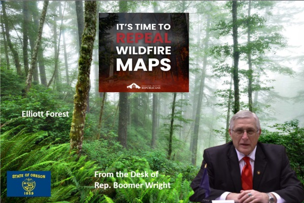
|
Getting your Trinity Audio player ready...
|
by Rep. Boomer Wright
In 2021, the Oregon legislature passed Senate Bill 762, a comprehensive wildfire management bill aimed at addressing the increasing threat of wildfires across the state. The bill introduced various measures, including new regulations and programs intended to enhance wildfire preparedness and response.
After implementation of the bill resulted in extreme public backlash, the Oregon Legislature adopted SB 80 in 2023 to try and remedy some of these concerns. While the intent of SB 762 was to improve safety, many rural Oregonians have raised concerns about the bill’s impact on property rights and the effectiveness of certain provisions.
Benefits of a statewide wildfire prevention program
A well-designed and run wildfire prevention program is essential to safeguard our homes, businesses, and natural resources from the devastating effects of wildfires. If funded and correctly, such programs can provide much-needed funding for firefighting equipment, personnel, and training, ensuring that our communities are better prepared to face wildfire threats.
Effective prevention efforts include practices like prescribed burns and forest thinning, which reduce fuel for fires and help maintain healthy ecosystems. Statewide programs can encourage cooperation between local communities, state agencies, and private landowners to develop tailored solutions that respect property rights while enhancing safety.
These ideas were the intention behind SB 762 and SB 80. Unfortunately, poor drafting and weaponization of some of the concepts have led to disaster.
Drawbacks of the SB 762 wildfire map
Inaccurate and overreaching mapping: SB 762 outlined very specifically how Oregon State University and ODF must model fire risk and design the map. Because of the language of the bill and technical difficulties, both versions of the map have been fraught with errors and inaccuracies, misclassifying properties and causing undue harm.
The maps also raise due process concerns. Properties have been labeled as “high-wildfire hazard” based on five specific factors and computer modeling. They are designated without proper sites assessments or transparency in the methodology used. The public also has limited access to the data used. Above all, there is NO consideration for any actions property owners take to safeguard their properties or on the ground conditions.
Weaponization of the wildfire map: Many organizations and stakeholders were opposed to the adoption of the wildfire map because of fears that it could be weaponized to prevent people from living and working in rural areas. These fears were well-founded, as some organizations were putting forth policy papers that encouraged the legislature to prevent new or replacement homes or structures in the wildland-urban interface, or WUI.
Unfortunately, that fear has been realized this session with SB 79, which proposes to eliminate new or replacement dwellings on properties that are high hazard and in the WUI.
Insurance: At the time the maps were rolled out, many residents experienced increased insurance premiums or policy cancellations, directly impacting their financial stability. Legislators should understand, however, that the State Wildfire Hazard Map is NOT responsible for these increases. Insurance companies have their own maps and modeling. It is also illegal for them to consider the state map. Despite these assurances, the public still believes SB 762 was responsible for their insurance issues.
Reduced property values: Having properties labeled as “high wildfire hazard” on a publicly available map put out by the state inherently reduces property values. Property owners have reported significant decreases in their property values because of their hazard designation. Additionally, the map, coupled with new regulations and insurance issued, made it significantly more difficult to sell homes and properties in Southern and Central Oregon.
Regulatory burdens: Under SB 762 and SB 80, properties designated at “high wildfire hazard” and in the WUI must comply with new defensible space requirements for existing structures and home hardening requirements for remodeled or new structures.
While defensible space and home hardening are good public health and safety regulations, proven to keep people safe, some members of the public have expressed significant concerns about their ability to afford and comply with these regulations, and fear they risk losing their properties if they can’t comply.
For any property owner, the risk of losing their property is always a concern. Regulations, nuisance violations and civil penalties can threaten the right to own your own property. This issue is exacerbated for those who are at a heightened risk of foreclosure, such as seniors, disabled veterans, single-parents, widows, low-income households, and those who shoulder the weight of home and property ownership differently than others.
It’s time to repeal wildfire maps.
Rep. Boomer Wright represents House District 9, which includes all of the Lane County coast and more, spanning from the north end of Yachats to the south end of Coos Bay. District 9 also encompasses the communities of Cheshire, Florence, Lakeside, Mapleton, North Bend, Reedsport, Scottsburg, and Triangle Lake. Contact Boomer at (503) 986-1409 or email Rep.BoomerWright@oregonlegislature.gov.