Volunteer praises city efforts to improve safety for bicyclists and pedestrians
9 min read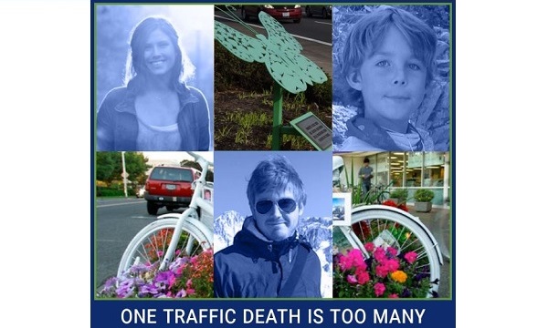
Presenter: A report about the August meeting of Eugene’s Active Transportation Committee drew questions from a listener. With a record 22 transportation-related fatalities last year, is the city considering more bicycle and pedestrian bridges over high-speed corridors?
We reached out to the co-chair of the ATC for the answer, and he said a bike and pedestrian bridge is planned to cross the Beltline to North Eugene High School. Charlie Loeb:
Charlie Loeb: This was originally sparked by a question from a listener who was wondering what the city’s doing, and I’m happy to say that the city’s doing a lot, but you know, we’re making up for decades of rules favoring vehicles, rules and infrastructure that were built for the convenience of cars.
[00:00:42] Presenter: Charlie shared background on the ATC.
[00:00:45] Charlie Loeb: I’m here today just speaking for myself. We are an advisory group to the city of Eugene’s transportation planning team. Mostly it’s just to serve as a sounding board or focus group for city staff. So a group of knowledgeable cyclists and walkers and skateboarders and scooters that they can come to and say, ‘Hey, we’ve got this project we’re working on. Let’s tell you about it and you give us feedback. And so that’s really our basic, fundamental role.’
[00:01:17] Presenter: He also explained the purpose of the city’s Vision Zero plan. Charlie Loeb:
[00:01:22] Charlie Loeb: The goal is to lower fatal crashes and serious injuries to zero. And instead, since we started trying to implement that here, fatal crashes have skyrocketed—not due to anything the city has done, just that long-term infrastructure need.
[00:01:41] And certainly, going beyond that, there’s issues with driver behavior. Without enforcement, the infrastructure itself tends to signal to people how fast they can drive.
[00:01:53] For instance, 47th and 48th Street down here in Southeast Eugene are places that people complain because there’s cut-throughs from Willamette Street over to Donald.
[00:02:04] But that doesn’t happen on 49th. And the reason is a traffic diverter, so people don’t cut through there because you can’t turn onto the street from Willamette, so you don’t have that high-speed traffic.
[00:02:16] Other places, you can convince traffic to slow down by narrowing the street. And here and there around the city, you’ll see curb bump-outs. Those curb bump-outs have two effects. One, they create a visual narrowing of the street, which signals to drivers, ‘Oh, I’m coming into a tighter area. I need to pay more attention.’ It also shortens the distance that pedestrians have to cross a street so that it is protective that way. Less time for the pedestrians to be exposed to traffic.
[00:02:45] Those are real simple, albeit they come with a cost. And like then anything involved in construction, a higher cost than you would expect.
[00:02:53] You know, there’s all the traffic calming things you can do. All those speed cushions along Jefferson and Friendly, for example, that can help slow down traffic. You can put in crossing islands partway across the street, which both visually narrows, it provides a narrow space for vehicles to squeeze through, and also provides a refuge for pedestrians and cyclists.
[00:03:14] You think about a place like 19th and Alder Street where there’s one of these features and they’re going to restore the one at the Amazon Path and 24th.
[00:03:26] Another thing which usually helps slow traffic down—raised crosswalks—so that people on the sidewalk can cross at level and it creates kind of a speed bump that would slow down traffic.
[00:03:37] You can see other examples of those raised crosswalks at 13th at Lincoln, and that one’s quite abrupt and definitely slows traffic down ’cause you don’t want to hit that at speed.
[00:03:46] And then right there by South Eugene High School where the Amazon Path terminates and crosses 19th and connects with the High Street protected bikeway.
[00:03:55] And you know, the linkage between the East Amazon protected bikeway to the Amazon path to the High Street protected bikeway creates an entire cross-Southeast route. That takes you really all the way from the quieter local streets that will go all the way up to the start of the Ridgeline Trail at Martin Street out to the river at Campbell Community Center.
[00:04:16] So you feel like you have a complete route that you can use to go from one part of the city to another that’s largely protected from traffic. And we’re working toward that for cyclists, a complete network of routes around the city that will enable you to feel safe.
[00:04:35] And they’re really effective. I mean, I would say that since the East Amazon bikeway went in, I have seen families with young kids out there biking. I’ve seen groups of kids biking on their own. When that protected bikeway wasn’t there, you would never see that. That’s because that street was so wide, it was really high-speed and really scary. I wouldn’t bike on it.
[00:04:56] And I think that’s a great example of infrastructure the city has put in that’s really making a difference and really enabling folks to get where they need to go who, again: too young to drive, too old to drive, don’t want to have a car, can’t afford a car, whatever the reason, without feeling like their life is in danger from the surrounding vehicle traffic.
[00:05:19] Presenter: The ATC has also played a key role in promoting infrastructure for people walking. Charlie Loeb:
[00:05:25] Charlie Loeb: The city staff is very generous and we at times can bring them things to think about and try to initiate some level of additional action that hadn’t been contemplated.
[00:05:37] The most notable example of this recently is sidewalk repair. So that all started with the ATC, sending a letter to staff saying, ‘Hey, the sidewalks are crap. What can we do in order to make it better?’ And there was some back and forth with city staff, and then ultimately a group of ATC members spun off into CURBS, Community United to Repair Broken Sidewalks, which is separate from ATC now.
[00:06:06] It has been very successful at getting people mobilized to talk about sidewalks and how we can do sidewalk repair. And, you know, and that’s been elevated to the point where the City Council had a work session on it.
[00:06:18] When people are wondering why city streets aren’t safer for cyclists and pedestrians and scooters, you know, a lot of it has to do with where all the investment has gone historically. You know, Eugene, like the rest of the United States, is a very car-centric place, and we have spent decades making life really convenient for people who drive.
[00:06:42] And the result has been a lot of real underinvestment for folks who either can’t drive, don’t want to drive, can’t afford a car, would rather not afford a car, which is a huge expense for a lot of families. And the infrastructure that would support people who don’t drive is really lacking and it’s going to take a huge amount of investment to overcome that.
[00:07:05] And the city to its credit is really working on that and has been for a while. And you can see a lot of big changes that have taken place.
[00:07:14] I’ve been here around 10 years and just in that time, for example. we’ve seen the East Amazon protected bikeway, the 13th Street protected bikeway, the High Street protected bikeway.
[00:07:26] We’ve got more of those coming. We’re going to have a protected bikeway on 24th. We’re going to have one on Lincoln Street. We’re going to have one on Oakway.
[00:07:35] And I do want to give a lot of credit to city staff. The city planning staff are very cognizant of the need to try to respect and provide infrastructure for people who don’t drive. And it’s good even for drivers. It’s good because it keeps congestion on the roads down if you have more people cycling and walking and scooting. But it’s really good for the people who, you know, have to get around by some other way, or choose to.
[00:08:01] And I’ll give a specific example. The city has a repaving project scheduled for 24th Avenue between, roughly Harris and Agate. And when they were looking at that repaving project, they started thinking about, ‘Well, you know, should we be providing a better cycling infrastructure along this major corridor, which is, you know, in the University and South Eugene area.’
[00:08:24] And so they reached out and engaged the community, had public meetings, did parking surveys, and ultimately decided that a better use of the street space would be to provide protected bikeways along 24th rather than the parking that’s there now.
[00:08:39] And that’s a hard thing to do. People don’t like to lose their parking, but it is part of reclaiming street space for something other than cars. And in this case, the city determined that the need for having a safe cycling corridor outweighed the need of the property owners who currently like parking in front of their homes on the street.
[00:08:58] Presenter: We asked about his efforts for better cycling infrastructure. Charlie Loeb:
[00:09:02] Charlie Loeb: We’re certainly always pushing for closing gaps in the cycle network and figuring out places that might be a deterrent to cyclists because they feel unsafe in areas that are otherwise safe.
[00:09:16] And I’ll give a couple of great examples: Alder Street, wonderful cycling route. Virtually every intervention you can think of, from buffered two-way bike lanes to protective traffic islands, to traffic diverters, to traffic calming, it’s all there on Alder Street between the University and all the way up to 32nd where there’s one last traffic diverter there.
[00:09:39] But there are some spots that feel dangerous. The crossing at 24th, whichever way you’re headed, you know, 24th is a pretty high-speed traffic corridor.
[00:09:48] Likewise at 30th. If you can get across 30th, you can continue along into South Eugene and connect up with the East Amazon protected bikeway, but crossing 30th, there is one of those rapid response flashing beacons (RRFBs) there that is very convenient for pedestrians to use to get across 30th. It’s not very convenient for cyclists to use and coming up with a solution that makes it easy and safe, and make it feel safe for cyclists to get across there at 30th. It’s something that’s important for just completing that corridor and making Alder Street along its length really work as part of a bicycle network.
[00:10:27] There’s another example at 15th and Jefferson. 15th is a great street for cyclists, which just before (Jefferson) then connects with the Fern Ridge Path and helps provide an east-west corridor all the way across the city.
[00:10:39] A personal interest of mine is in trying to build a sense of identity for some of these routes—coming up with names for them, specialized signage. So for instance, for that East Amazon to Amazon Path to High Street, it creates a route, but we don’t have anything to call that route or signs that would tell you you’re on this route.
[00:11:02] Personally, I’m in favor of coming up with a name that people can bond with, to build a sense of pride in those routes because then folks will notice when there’s a problem and say, ‘Hey, there’s a gap in this route that we really need to fix. And I care about this route. I live on the, you know, the Heron Route or the River Route .
So I think that creating that identity for these routes could help both help people figure out where they’re going, but also help build support for making them even better.
[00:11:31] There is another large-scale guidance for the city, which is the Complete Streets guidelines for allocating street space appropriately among all the different users for the street.
[00:11:43] You know, we have our public parks, but the public streets also belong to all of us. And Complete Streets says, ‘Well, how can we best allocate this space so that everyone is, you know, gets a fair shake with our streets?’ And those have been in draft form for some years, although city staff has been using the guidance and thinking about how they do transportation projects.
[00:12:07] I encourage people to take a look. They’re really kind of inspirational in terms of like, if we can do this, then, cyclists, pedestrians, skateboarders, scooters, one-wheelers and everyone else will have a fair part of the street space that we all have.
[00:12:22] Presenter: Charlie Loeb answers listeners’ questions about Eugene’s Vision Zero project and praises city transportation planners.